Hurricanes 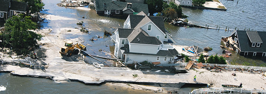
Enter into the Season Prepared: - The portion of the year having a relatively high incidence of hurricanes. The hurricane season in the Atlantic, Caribbean, and Gulf of Mexico runs from June 1 to November 30.
- If you live in a coastal area, call your Municipality’s emergency management office to identify your evacuation route that includes designated safe areas, areas to be evacuated during a hurricane emergency, and safe evacuation routes to shelter.
- Hurricanes can cause extensive flooding, not just along the coastline, but far inland as well. Flood insurance is valuable financial protection.
- Your annual preparations for the hurricane season should include checking to see that you have a supply of non-perishable food, drinking water containers, waterproof matches, a lantern with fuel, a first aid kit, fire extinguisher, a battery-powered radio, flashlights, and extra batteries.
Advisories and Warnings The National Weather Service can usually provide up to five days of advance warning. The Weather Service of NOAA issues advisories when hurricanes approach land. Hurricane WatchAn announcement that sustained winds of 64 knots (74 mph or 119 km/hr) or higher are possible within the specified area in association with a tropical, subtropical, or post-tropical cyclone. Because hurricane preparedness activities become difficult once winds reach tropical storm force, the hurricane watch is issued 48 hours in advance of the anticipated onset of tropical storm force winds. Hurricane WarningAn announcement that sustained winds of 64 knots (74 mph or 119 km/hr) or higher are expected somewhere within the specified area in association with a tropical, subtropical, or post-tropical cyclone. Because hurricane preparedness activities become difficult once winds reach tropical storm force, the warning is issued 36 hours in advance of the anticipated onset of tropical-storm-force winds. The warning can remain in effect when dangerously high water or a combination of dangerously high water and waves continue, even though winds may be less than hurricane force. BEFORE- Keep tuned to a local radio or television station for the latest National Weather Service advisories as well as instructions from local officials.
- Check battery-powered equipment. Your battery-operated radio could be your only source of information, and flashlights will be needed if utility services are interrupted. Buy extra batteries.
- Keep your car fueled should evacuation be necessary. Some service stations may be closed or inoperable after the storm strikes.
- Leave early from low-lying beach areas that may be swept by high tides or storm waves, or mobile homes that are vulnerable to overturning in strong winds.
- Store drinking water in clean bathtubs, jugs, bottles and cooking utensils as your town's water system could be contaminated or damaged by the storm. You should have a gallon of water per family member for a minimum of three days.
- Obtain a minimum of three days supply of prescription medications and medical supplies.
- Board up windows or protect them with storm shutters.
- Secure outdoor objects that might become caught in the wind.
- Moor your boat securely well before the storm arrives, or move it to a designated safe area early. Do not stay on your boat or you may drown.
- Be alert for tornado watches and warnings as tornados are frequently spawned by hurricanes. Should your area receive a tornado warning, seek shelter immediately in an interior bathroom or small hallway, preferably below ground level.
DURING- Remain indoors. Blowing debris can injure and kill. Travel is dangerous.
- Be especially wary of the "eye" of the hurricane. If the storm center passes directly overhead, there will be a lull in the wind lasting from a few minutes to half-an-hour or more. At the other side of the "eye" the winds will increase rapidly to hurricane force, and will come from the opposite direction.
AFTER- If you are in a public shelter, remain there until those in charge inform you that it’s safe to leave.
- Keep tuned to your local radio or television station for advice and instructions from local government about emergency medical, food, housing, and other forms of assistance.
- Stay out of disaster areas and do not use the telephone except for rescue, serious injuries or emergencies.
- Do not drive unless you must. Roads should be left clear for emergency vehicles and debris filled streets are dangerous. Along the coast, soil may be washed from beneath the pavement or bridge supports, which could collapse under the weight of a car.
- Avoid and report loose or dangling wires and broken sewer, gas or water mains to the appropriate utility company.
- Prevent fires by not using candles if at all possible.
- Check buildings for possible collapse or weakened structure before re-entry.
- Hurricanes moving inland can cause severe flooding. Stay away from riverbanks and streams until all potential flooding is past.
- If power is off, check refrigerated food for spoilage. Do not use tap or well water until you are sure that it is not contaminated.
|